
Anúncios
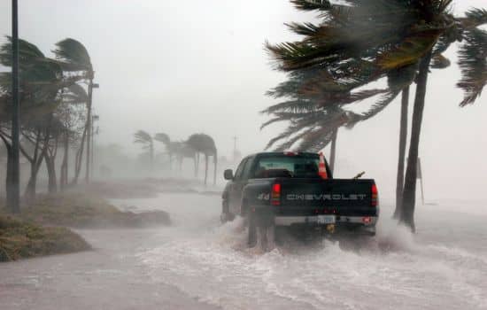
Extreme weather events are becoming more frequent and unpredictable. Having a reliable storm, hurricane, and natural disaster prediction app on your smartphone can be the difference between safety and danger.

Climate change has intensified the need for accurate weather forecasting tools. Whether you live in a hurricane-prone coastal area, tornado alley, or regions susceptible to flooding and wildfires, being informed ahead of time empowers you to make critical decisions. Modern technology has made it possible to track these phenomena in real-time, right from your pocket.
Anúncios
This comprehensive guide explores how storm prediction apps work, their essential features, and why they’ve become indispensable tools for millions worldwide. We’ll dive into the science behind disaster forecasting, examine the best features to look for, and help you understand how these applications can protect you and your loved ones.
🌪️ Understanding the Technology Behind Weather Prediction Apps
Weather prediction applications leverage sophisticated meteorological data from multiple sources. These include satellite imagery, ground-based radar systems, ocean buoys, weather stations, and advanced computer modeling. The integration of these data streams creates a comprehensive picture of atmospheric conditions that allows forecasters to predict severe weather events with increasing accuracy.
Anúncios
Machine learning and artificial intelligence have revolutionized weather forecasting in recent years. These technologies analyze historical weather patterns alongside current conditions to identify trends that human forecasters might miss. The result is earlier warnings and more precise predictions about storm paths, intensity, and potential impact areas.
Most advanced weather apps update their forecasts every few minutes, providing near-instantaneous information about changing conditions. This real-time capability is particularly crucial during rapidly developing weather events like tornadic supercells or flash flood situations where minutes can make the difference in getting to safety.
Data Sources That Power Prediction Accuracy
Professional-grade weather apps pull information from agencies like NOAA (National Oceanic and Atmospheric Administration), the European Centre for Medium-Range Weather Forecasts (ECMWF), and various national meteorological services worldwide. This global network ensures comprehensive coverage regardless of your location.
Crowdsourced data has also become an valuable component. Some applications allow users to report local conditions, creating a hyper-local weather network that supplements official sources. This combination of professional meteorological data and community reporting enhances accuracy, especially for localized phenomena.
🌊 Essential Features for Storm and Hurricane Tracking
When evaluating disaster prediction apps, certain features distinguish excellent tools from basic weather applications. Real-time storm tracking should be at the top of your list. This feature displays active weather systems on an interactive map, showing their current position, projected path, and estimated arrival times for your location.
Push notifications and customizable alerts are absolutely critical. The app should allow you to set specific thresholds for different weather conditions—wind speed, precipitation rates, temperature drops, or tornado warnings. These alerts should be immediate, reliable, and informative enough to guide your response.
Multi-layer radar visualization helps you understand weather patterns at different atmospheric levels. The ability to toggle between precipitation intensity, cloud cover, wind patterns, and temperature gradients provides a complete picture of developing systems. Some apps even offer future radar, projecting where storms will be hours ahead.
Hurricane-Specific Tracking Capabilities
For coastal residents, dedicated hurricane tracking features are non-negotiable. The best apps display the official National Hurricane Center cone of uncertainty, historical track data, and intensity forecasts. They should clearly show wind speed categories, storm surge predictions, and evacuation zone information.
Advanced hurricane tracking includes spaghetti models—multiple computer-generated forecast tracks that illustrate the range of possible storm paths. While these can appear confusing initially, they provide valuable insight into forecast confidence and potential scenario planning.

⚡ Tornado Warning Systems and Severe Weather Alerts
Tornadoes represent one of nature’s most violent and unpredictable phenomena. Quality weather apps incorporate dual-polarization radar technology that can detect debris signatures—the telltale sign of a tornado on the ground. This capability provides warnings even before official tornado warnings are issued.
Location-based alerting ensures you receive notifications specific to your exact coordinates rather than general county-wide warnings. This precision reduces alert fatigue while ensuring you’re informed about genuine threats to your immediate area.
Many applications now include lightning detection networks that track cloud-to-ground strikes in real-time. This feature is invaluable for outdoor activities, sports events, and work situations where lightning poses a serious risk. The apps typically calculate the distance to the nearest strike and provide safety countdowns.
🔥 Wildfire Tracking and Air Quality Monitoring
Wildfires have become an increasingly critical concern, particularly in western regions and areas experiencing drought conditions. Modern disaster apps now incorporate active wildfire tracking using satellite thermal detection and perimeter mapping from firefighting agencies.
Air quality indices have become essential health information during wildfire season. The best apps display PM2.5 concentrations, visibility estimates, and health recommendations based on current conditions. Color-coded maps make it easy to assess whether outdoor activities are safe or should be postponed.
Some advanced applications offer smoke plume forecasting, predicting where wildfire smoke will travel over the coming days. This feature helps residents in areas hundreds of miles from active fires prepare for deteriorating air quality before it arrives.
🌊 Flood Prediction and Water Level Monitoring
Flooding kills more people annually than any other weather-related disaster. Comprehensive weather apps include stream gauge data from thousands of monitoring stations, displaying current water levels alongside flood stage thresholds. This information is critical for residents near rivers, streams, and flood-prone areas.
Flash flood prediction has improved dramatically with high-resolution rainfall rate monitoring. Apps can calculate rainfall totals over specific time periods and compare them against known flash flood triggers for particular watersheds. This localized analysis provides earlier warnings than general flood watches.
Urban flooding has become a major concern as climate patterns shift and development increases impervious surfaces. Modern apps incorporate drainage system capacity data and topographical information to predict which neighborhoods face the highest risk during heavy rainfall events.
🛰️ The Role of Satellite Technology in Disaster Forecasting
Next-generation weather satellites have transformed prediction capabilities. Geostationary satellites provide continuous monitoring of the same geographic area, capturing images every few minutes. This rapid refresh rate allows meteorologists to observe storm development and intensification in near-real-time.
Polar-orbiting satellites complement geostationary systems by providing high-resolution data as they pass over different regions. These satellites carry advanced instruments that measure atmospheric temperature, moisture content, and wind speeds at various altitudes—essential data for forecast models.
Satellite-derived products like water vapor imagery reveal atmospheric dynamics invisible to conventional radar. Weather apps that incorporate these specialized visualizations give users professional-level tools for understanding complex weather systems and their potential evolution.
📱 User Interface and Accessibility Considerations
Even the most powerful weather prediction engine becomes useless if the interface is confusing or difficult to navigate during emergencies. The best apps balance comprehensive data with intuitive design, allowing users to access critical information within seconds of opening the application.
Customizable home screens let you prioritize the information most relevant to your situation. Whether that’s current radar, active alerts, hourly forecasts, or specific weather parameters, you should control what appears immediately upon launching the app.
Dark mode and high-contrast options improve readability in various lighting conditions and during power outages when you might be relying on limited battery power. Font size adjustments and simplified emergency modes ensure accessibility for all users, including elderly individuals and those with visual impairments.
🔋 Offline Functionality and Battery Efficiency
Disaster situations often involve power outages and network disruptions. The most reliable weather apps offer offline functionality, caching recent radar images, forecasts, and alert information so you can access critical data even without an internet connection.
Battery optimization becomes crucial during extended emergency situations. Look for apps that offer power-saving modes that reduce update frequency and display features while maintaining essential alert functionality. Some applications allow you to download specific geographic regions for extended offline use.
Widget support enables you to view current conditions and active alerts without opening the app, conserving both battery life and precious seconds during rapidly developing situations.
🌍 Global Coverage vs. Regional Specialization
Some weather apps provide worldwide coverage with consistent features across all regions, while others specialize in specific geographic areas with enhanced local capabilities. Global apps are ideal for travelers and those with interests in multiple locations, offering standardized data presentation regardless of where you are.
Regionally focused applications often provide superior localization, including partnerships with local emergency management agencies, integration with community warning systems, and specialized forecasting for region-specific weather phenomena. They may offer features like school closure notifications, road condition reports, and local broadcast meteorologist video updates.
The choice between global and regional depends on your specific needs. Many users find value in maintaining both types—a comprehensive global app for general weather monitoring and a specialized local app for detailed emergency information.
🎓 Educational Components and Weather Literacy
Understanding weather terminology and forecast products enhances your ability to make informed decisions. Quality apps include educational resources explaining what different alerts mean, how to interpret radar imagery, and what actions to take for various warning levels.
Interactive tutorials help users learn to identify dangerous weather signatures on radar, understand probability of precipitation forecasts, and recognize the difference between watches and warnings. This weather literacy transforms passive information consumers into active participants in their own safety.
Some applications offer historical weather data and case studies of significant past events, providing context for current situations and helping users appreciate the potential severity of forecasted conditions.
🔔 Integration with Emergency Management Systems
The most effective disaster prediction apps integrate directly with official emergency management networks. This includes Wireless Emergency Alerts (WEA), FEMA notifications, and local emergency operations center communications. Seamless integration ensures you receive all official warnings through a single, familiar interface.
Evacuation route planning has become a feature in some advanced applications, displaying recommended routes based on current road conditions, traffic patterns, and the forecasted path of approaching disasters. This capability can be life-saving during hurricane evacuations or wildfire escapes.
Community emergency features allow users to check in as safe, request assistance, or report hazardous conditions to authorities. These social components transform weather apps into comprehensive emergency management tools that facilitate communication when traditional channels may be overwhelmed.
💡 Making the Most of Your Weather App
Simply downloading a weather app isn’t enough—you need to configure it properly and understand how to use it effectively. Spend time during calm weather exploring all features, customizing alert thresholds, and familiarizing yourself with the interface so you can navigate it quickly during emergencies.
Set up location-based alerts for multiple addresses including your home, workplace, children’s schools, and elderly relatives’ residences. This comprehensive coverage ensures you’re informed about threats to everyone in your circle of concern.
Regularly review and update your alert settings as your needs change with seasons. Tornado alerts might be critical in spring but less relevant in winter, while winter storm warnings become priorities as temperatures drop. Adjusting your notifications prevents alert fatigue while maintaining awareness of relevant threats.
🚀 The Future of Disaster Prediction Technology
Weather prediction technology continues to advance rapidly. Artificial intelligence models are beginning to supplement and sometimes outperform traditional numerical weather prediction in certain applications. These AI systems can process vast amounts of data and identify subtle patterns that improve forecast accuracy, particularly for extreme events.
Hyperlocal forecasting powered by dense sensor networks and IoT devices promises street-level precision for weather predictions. Imagine receiving a notification that heavy rain will arrive at your exact address in 12 minutes—this level of specificity is becoming reality in some urban areas.
Augmented reality features are emerging that allow users to point their phone camera at the sky and see overlaid radar data, storm directions, and hazard information superimposed on the actual view. This immersive technology helps people better understand abstract weather data in relation to their immediate environment.
The integration of weather data with smart home systems enables automated responses to forecasted conditions—closing storm shutters before hurricane winds arrive, adjusting irrigation based on rainfall predictions, or activating backup power systems when severe weather threatens electrical service.
Staying safe during extreme weather events requires reliable information delivered in a timely, understandable format. The right storm prediction app provides that critical link between meteorological science and personal safety decisions. By understanding the features that matter most and choosing applications that meet your specific needs, you transform your smartphone into a powerful tool for disaster preparedness and response. In an era of increasing weather volatility, this technology has become not just convenient, but essential for protecting what matters most. ⛈️